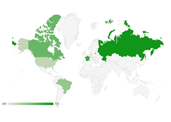

Google Geo Chart is a visualization tool provided by Google Charts.
The Geo Chart specifically is designed to display geographical data on a map. It allows users to visualize data by region, such as countries, regions within a country, or even specific locations like cities.
| Created by: | Pablo Software Solutions |
| Added: | June 28, 2024 |
| Last update: | June 28, 2024 |
| Version: | 1.0.0.0 |
| Category: | Miscellaneous |
| Designed for: | WYSIWYG Web Builder 16 (and up) |
| Downloads: | 99 |
| 64bit support: | Yes |